

The major risks facing municipalities and their territories.
Floods, wildfires, heatwaves, droughts, but also health, social and cyber crises: territories face multiple, overlapping exposures. Adaptation is becoming a management skill in its own right, alongside budgeting and planning.
What we hand overFive families of risk to hold at once.
A local authority handles several types of risk at once, with the same teams and the same budget. They often overlap, and a single crisis can set off two or three of them.
- ✦ Natural and climate risks (floods, wildfires, heatwaves, droughts)
- ✦ Health and social risks
- ✦ Technological and industrial risks
- ✦ Cyber risks affecting digital public services
- ✦ Insurance and budgetary risk, as coverage conditions keep deteriorating
These risks do not stay in their box. A prolonged drought means usage restrictions, strain on the drinking water supply, cracks in public buildings from clay shrink-swell and a review of insurance terms, all at once: four issues, four different departments.
Since COP16, France is officially a country affected by desertification. At the scale of a local authority, systemic risk reads right there: in the order services give way, and the order in which they will have to be restored.
The change, visible in seconds.
Three recent events in France: drag the handle to compare before and after.
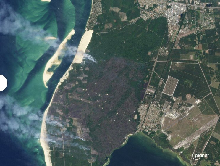
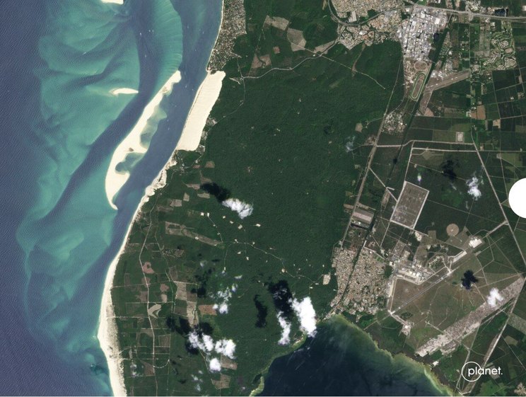
Planet Labs satellite imagery - La Teste-de-Buch wildfire (Gironde, France), July 2022. Over 6,500 hectares of forest destroyed within days.
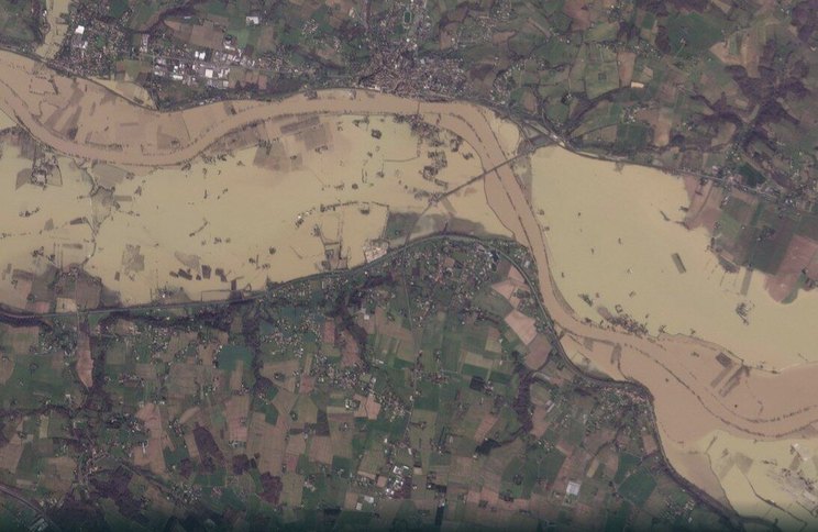
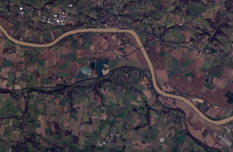
Planet Labs satellite imagery - Garonne river flood at La Réole (Gironde, France), February 2026. The river overflowed its banks between Agen and Langon following storm Nils (11–12 February 2026).
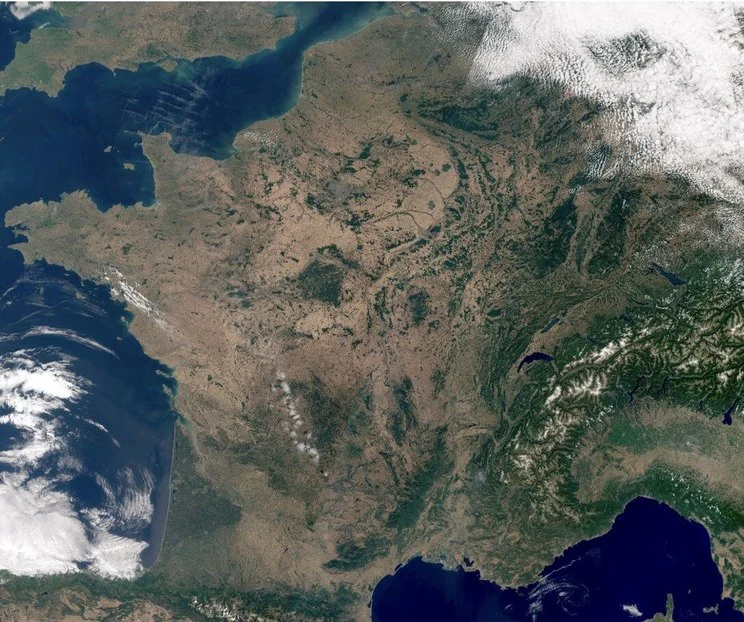
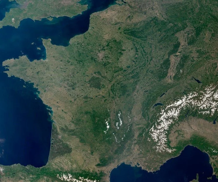
Natural-colour satellite imagery - mainland France, 27 May to 9 July 2026. Spring greening gives way to dried-out soils across much of the country - a drought affecting the whole territory, not just isolated areas.
From risk exposure to operational decisions.
A reading that feeds directly into your continuity plans and regulatory obligations.
Exposure diagnosis
Inventory of the hazards weighing on the territory, from natural to cyber risk.
Vulnerability analysis
Cross-referencing identified risks with population, infrastructure and public services.
Scenarios & prioritization
Building plausible crisis scenarios and ranking them by likelihood and impact.
Recommendations for action
Measures ranked by priority, each translated into an action to be taken.
Risk families covered: natural, health, technological and cyber.
A reading built at the scale of your municipality or EPCI.
Every recommendation states what it means in practice, and who owns it.
→ This diagnosis feeds directly into your PCS, PICS and DICRIM - the regulatory formalization that follows.
What you leave with.
Four deliverables to objectify your territory's exposure and inform your decisions.
Risk exposure diagnosis
Each risk listed, with its source, its location and its level of exposure.
Vulnerability mapping
The territory's sensitive sites, from schools to networks and venues open to the public.
Territorialized crisis scenarios
Written scenarios, usable directly as an exercise outline.
Operational recommendations note
A written note, ready to be filed with your safeguard plans and council decisions.